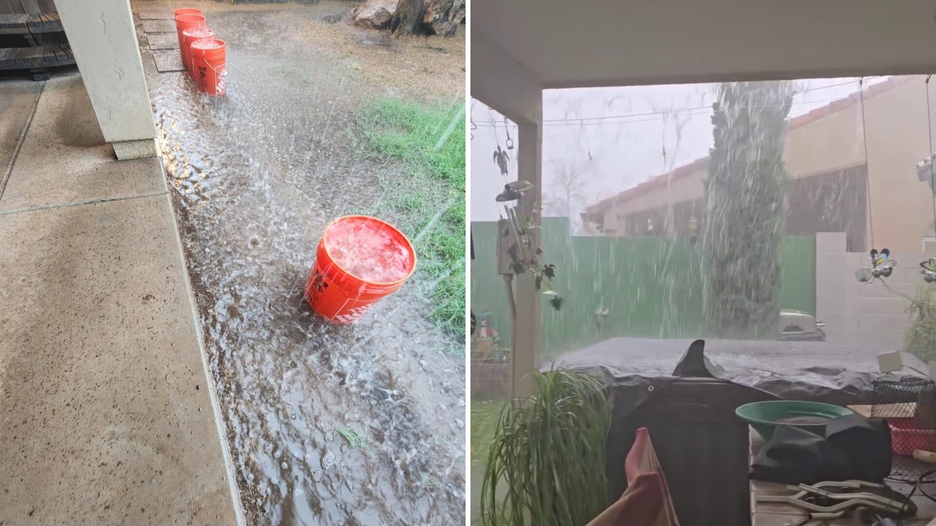
Phoenix experienced a dramatic weather event as monsoon storms swept through the region, bringing golf-ball-sized hail and heavy rain that disrupted travel both on the roads and in the air. The official Phoenix rain gauge at Sky Harbor recorded 1.64 inches of rain on this day, marking the most rainfall in a single day since 2018 and tying it as the fourth wettest day in Phoenix since 2000.
The rainfall today accounted for two-thirds of the total monsoon rainfall so far. The current monsoon rainfall in Phoenix stands at 2.55 inches, surpassing the average monsoon rainfall of 2.35 inches. This significant amount of precipitation has led to various disruptions, including a ground stop at Phoenix Sky Harbor that lasted until 4:30 p.m. on Friday, with American Airlines flights continuing until 6 p.m. Several flights were diverted to Los Angeles, Albuquerque, New Mexico; El Paso, Texas; Salt Lake City, and Denver.
In the East Valley, areas such as Tempe, Scottsdale, and Mesa all received over two inches of rain. Many locations across the Valley saw between half an inch to an inch of rain throughout the day. Showers and storms are expected to continue through the night in eastern Arizona, where thunderstorms could bring heavy rain, hail, and gusty winds. Meanwhile, Phoenix will see a temporary break from the storm activity.
Arizona State University canceled Sparky’s Tailgate due to the severe weather, although the Sun Devils’ game against TCU is still scheduled to proceed as planned. Weather forecasts indicate another First Alert Weather Day for tomorrow, with more showers and storms expected. Some of the heaviest rain is anticipated in southwestern Arizona, where showers and storms are likely to develop in the higher terrain areas north and east of Phoenix throughout the day.
Isolated to scattered showers may occur across metro Phoenix during the late morning hours into early Saturday afternoon. A spokesperson from Phoenix Sky Harbor Airport mentioned that 10 flights were diverted to other airports during the initial ground stops on Friday.
Flood conditions have caused damage to buildings and created muddy roads in the Globe-Miami area. Just before 10 a.m., rain began in the West Valley, with traffic cameras showing slick roads on the Loop 303 and Interstate 10. Pea-sized hail started falling near 7th and Missouri avenues.
The Arizona Department of Transportation urged drivers to check their windshield wipers, slow down, and avoid driving through pooling water. Due to these conditions, a First Alert Weather Day was declared for Friday.
An area of low pressure has moved into Southern California and is expected to remain stationary for the next few days, pulling abundant moisture into Arizona. A flood watch remains in effect through 8 p.m. tomorrow for southeastern Arizona, including the Tucson area.
There is still some lingering moisture into Sunday, with a slight chance for showers. Drier air is expected to move in next week. Below-normal temperatures will continue through the weekend, with highs in the upper 80s tomorrow and lower 90s on Sunday. Overnight lows are expected to dip into the lower 70s and upper 60s across the Valley this weekend.
Download the First Alert Weather App Here
First Alert Weather Radar
Rainfall Totals
See a spelling or grammatical error in our story?
Please click here to report it.
Do you have a photo or video of a breaking news story? Send it to us here with a brief description.