The King Charles III England Coast Path: A Journey Through the UK’s Stunning Shores
When completed, the King Charles III England Coast Path will be the longest managed shoreline-hugging trail in the world, stretching over 2,700 miles. This ambitious project will open up access to some of the most beautiful and diverse coastal landscapes in the UK, offering a unique opportunity for walkers to experience the full range of England’s coastline.
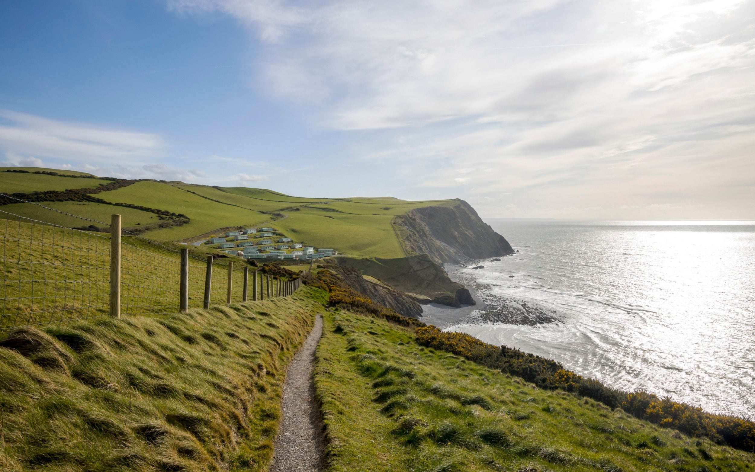
The diversity of the English coast is truly remarkable. From perilous cliffs that soar over 300 meters to nebulous salt marshes that merge into the waves, there is something for every nature lover. Sandy bucket-and-spade strands, smuggler-y coves, shanty-ringing fishing harbors, and bays full of rock pools and fossils all contribute to the rich tapestry of this coastline. And that’s just England. When considering the edges of Wales and Scotland, the total coastline stretches to over 11,000 miles, offering endless opportunities for exploration.
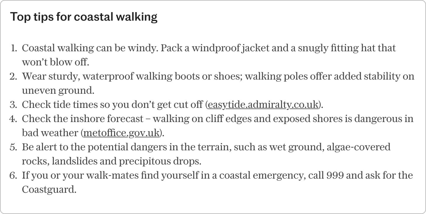
While it’s not necessary to walk the entire path, even a short stroll along the coast can provide a health-boosting dose of blue space and sea-salty air. For those feeling inspired, here are 10 great day walks that will deliver just that:
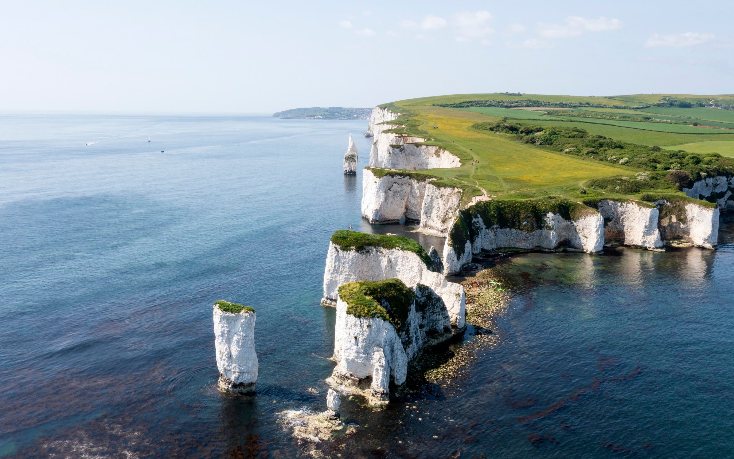
1. Isle of Purbeck, Dorset
Route:Loop from Studland; find the OS map here
Distance:6.25 miles
Duration:3-3.5 hours
The Jurassic Coast is jam-packed with geology at its most engaging and visually stunning. At the southern end of Studland Bay, it comes in the form of Old Harry Rocks, named after a notorious pirate. These chalk hills were eroded during the last Ice Age and continue to be shaped by the waves today.
A lovely loop from Studland village leads over the open chalk grasslands of Ballard Down, which are awash with wildflowers in summer and a great place for bird-spotting. The route also includes Godlingston Heath, which provided inspiration for Thomas Hardy.
Don’t miss:Agglestone Rock, a 400-tonne lump of iron-rich sandstone squatting on Godlingston Heath. According to legend, it was put there by the Devil himself.
Where to stay:The Pig on the Beach in Studland has doubles from £175 per night, room only.
2. East Neuk, Fife
Route:Elie to Anstruther or Crail; find the OS map here
Distance:6.5 miles to Anstruther or 10.5 miles to Crail
Duration:3-5 hours
The “nook” of Fife, where the Firth of Forth meets the North Sea, is the Scottish coast at its quaintest. Here, a series of winsome fishing villages unfurl, all lobster-potted harbours, tight-knit stone cottages, and excellent fish and chips. The plummest stretch is between Elie’s golden sands and photogenic Crail.
En route lie St Monans (home to a historic windmill, salt pans, and tidal swimming pool), the pretty port of Pittenweem, foodie Anstruther, and a varied shore of fascinating rocks, castle ruins, and slobbed-out seals. The Number 95 bus stops at every village, making it easy to stop when you like.
Don’t miss:An added boat trip from Anstruther to the seabird-swirled Isle of May Nature Reserve.
Where to stay:The harbourside Ship Inn in Elie has doubles from £156 per night, including breakfast.
3. Northumberland Coastal Path
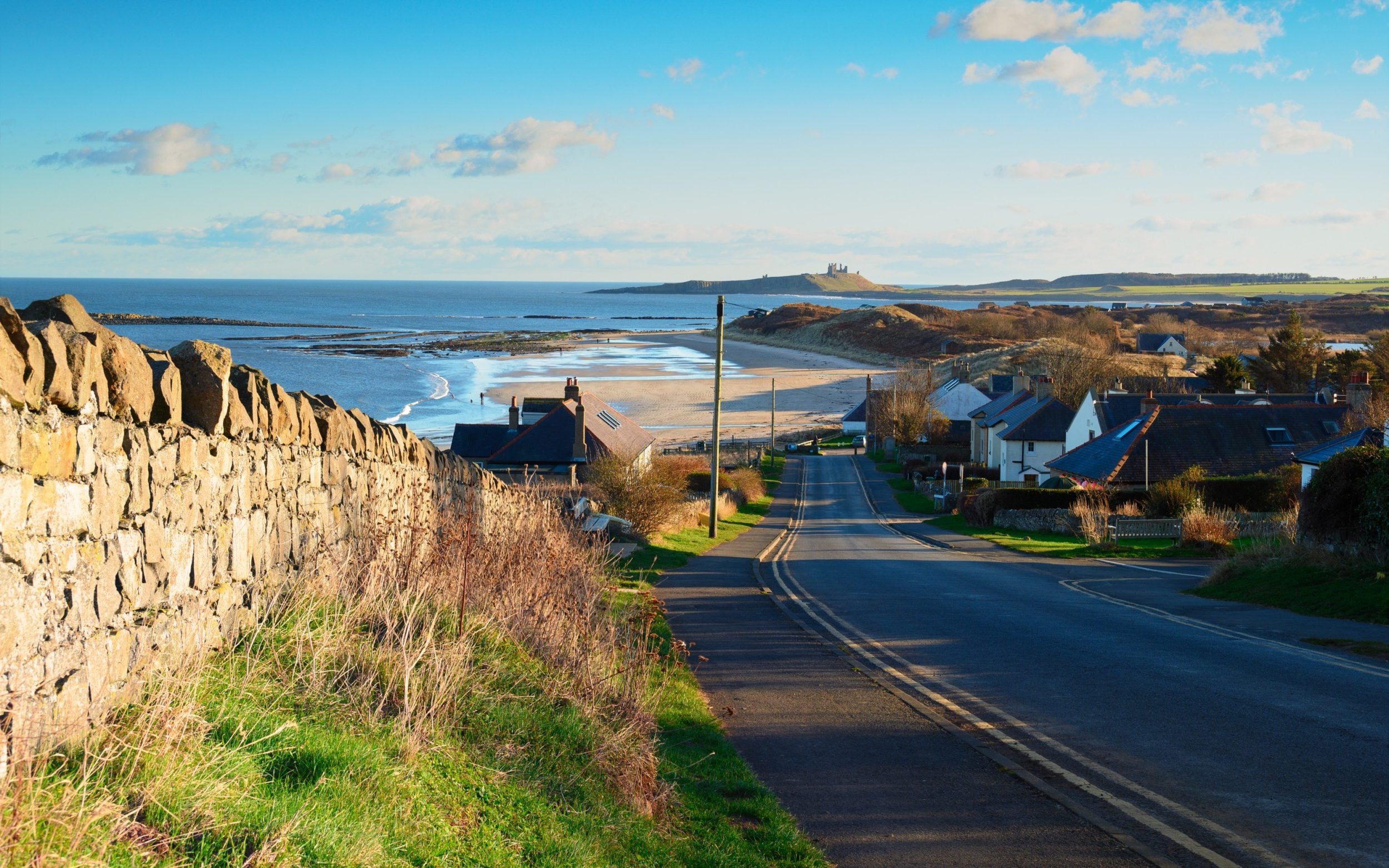
Route:Craster to Beadnell; find the OS map here
Distance:8.5 miles
Duration:4-4.5 hours
The Northumberland coast is an area of such outstanding natural beauty that it’s earned National Landscape status. A hiking path runs the length of it, but if you’ve only got one day, start from Craster’s harbour and head north. Almost immediately, the trail hits Dunstanburgh Castle, its 14th-century ruins seemingly slipping into the sea.
Beyond lie the blonde sands and rippling dunes of Embleton Bay, Newton Pool Nature Reserve (bring binoculars for the bird hides), and the golden curve of Beadnell Bay, beloved of fisher-folk and swimmers. Stop here, or continue a mile-ish more into vibrant Seahouses; the Alnwick-Berwick bus stops at villages along the route.
Don’t miss:The Ship Inn in Low Newton – in season, it serves lobster fresh from the bay.
Where to stay:A former 18th-century granary, Beadnell Towers has doubles from £155 per night, including breakfast.
4. Dinas Island, Pembrokeshire
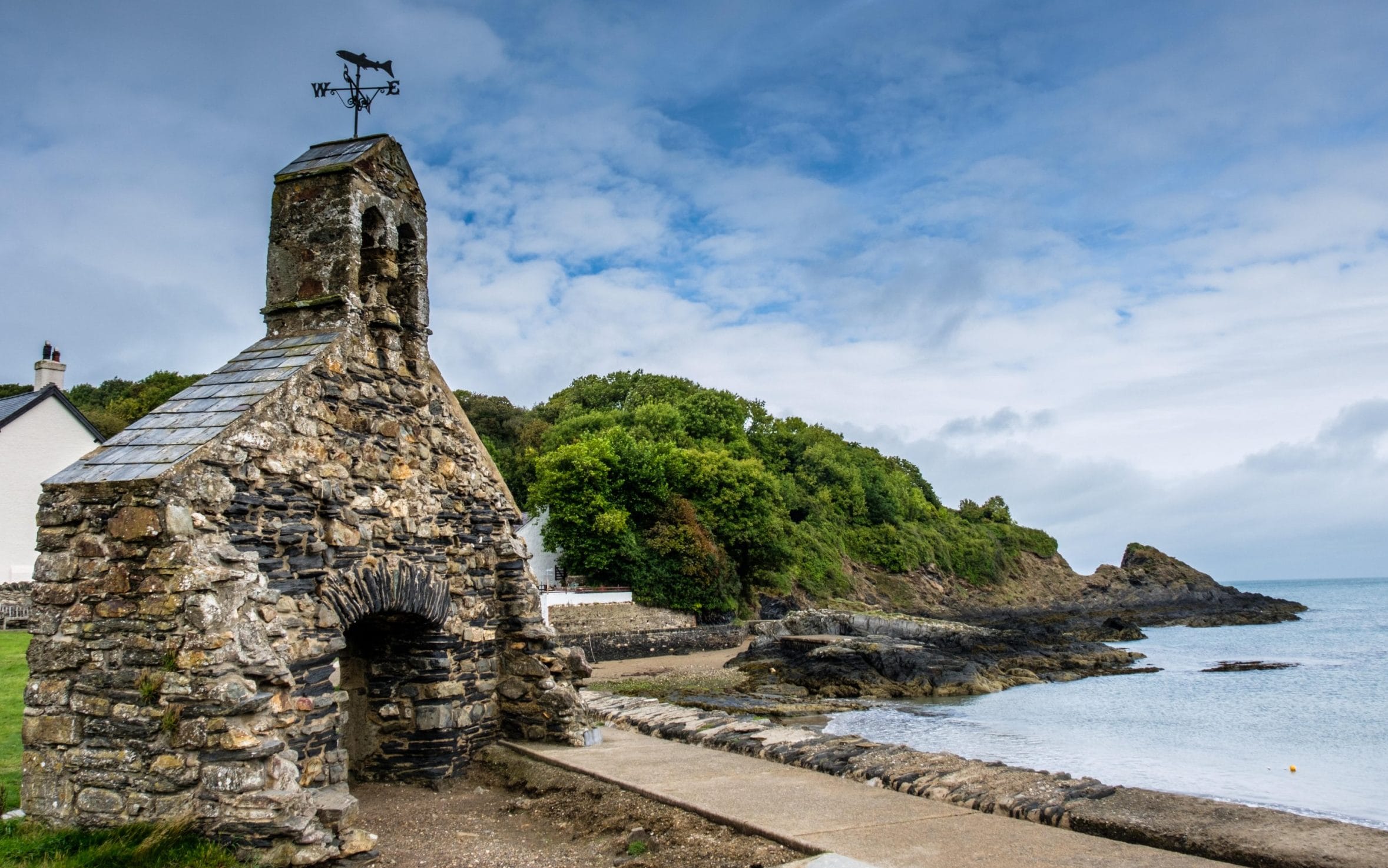
Route:Loop from Pwllgwaelod; find the OS map here
Distance:3 miles
Duration:1.5 hours
Small but mighty, that’s Dinas. The loop around this bulbous headland (it’s not an island at all) cramps all that’s fabulous about the 186-mile Pembrokeshire Coast Path into one short shot. There are lovely beaches, at both Pwllgwaelod and, a kilometre east through the woods, Cwm-yr-Eglwys; the latter also has a ruined seaside chapel.
Then there’s a thrilling cliff path that passes a seabird-flocked rock, and a trig point with 360-degree views: out to sea, along the craggy coast, and inland to the Preseili hills. Icing on the cake? Back in Pwllgwaelod, the Sailors’ Safety awaits, an old smugglers’ pub that’s had a gastro makeover.
Don’t miss:Training your binoculars on Needle Rock, just offshore – in summer, it’s a nesting spot for razorbills, guillemots, fulmars, and shag.
Where to stay:Llys Meddyg in nearby Newport has chic-n-cosy doubles from £126 per night, including breakfast.
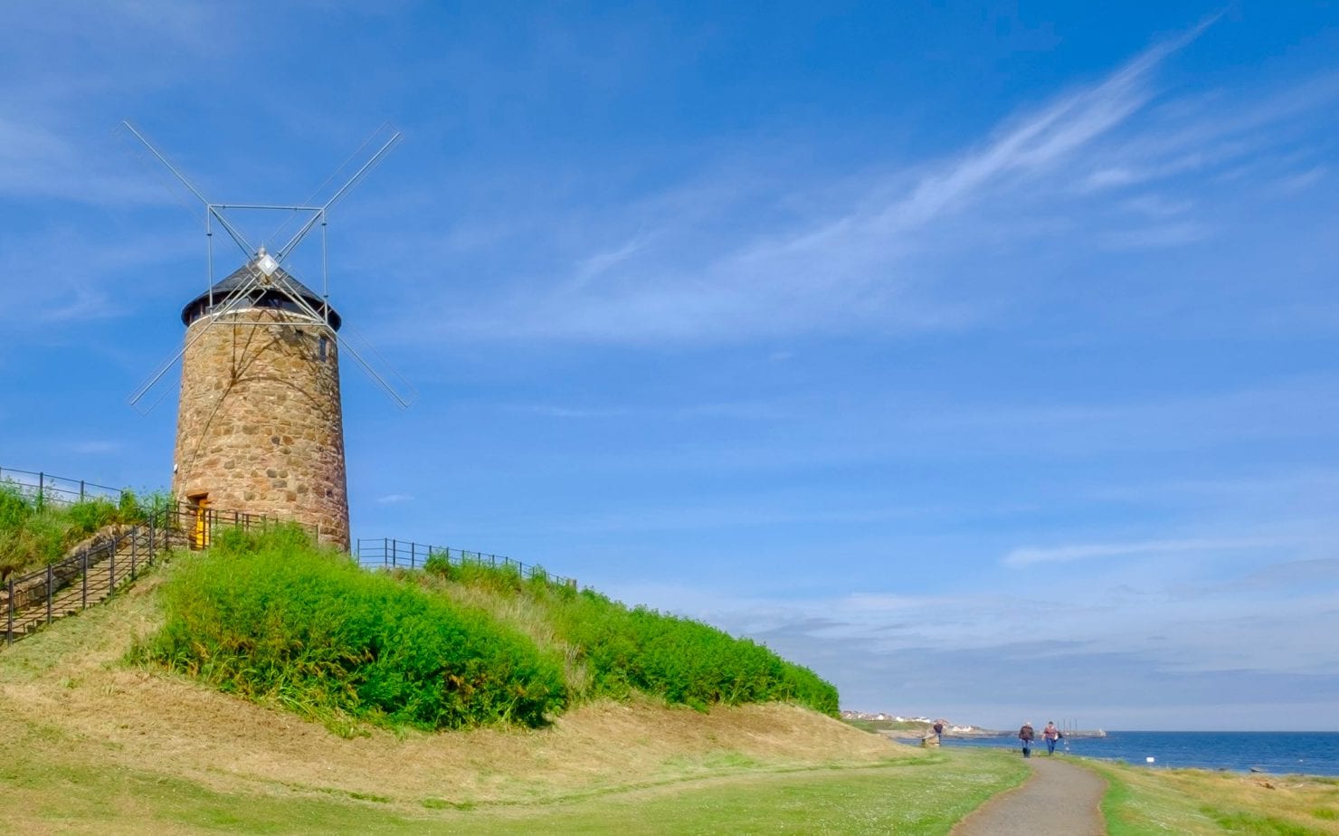
5. North Norfolk, Norfolk
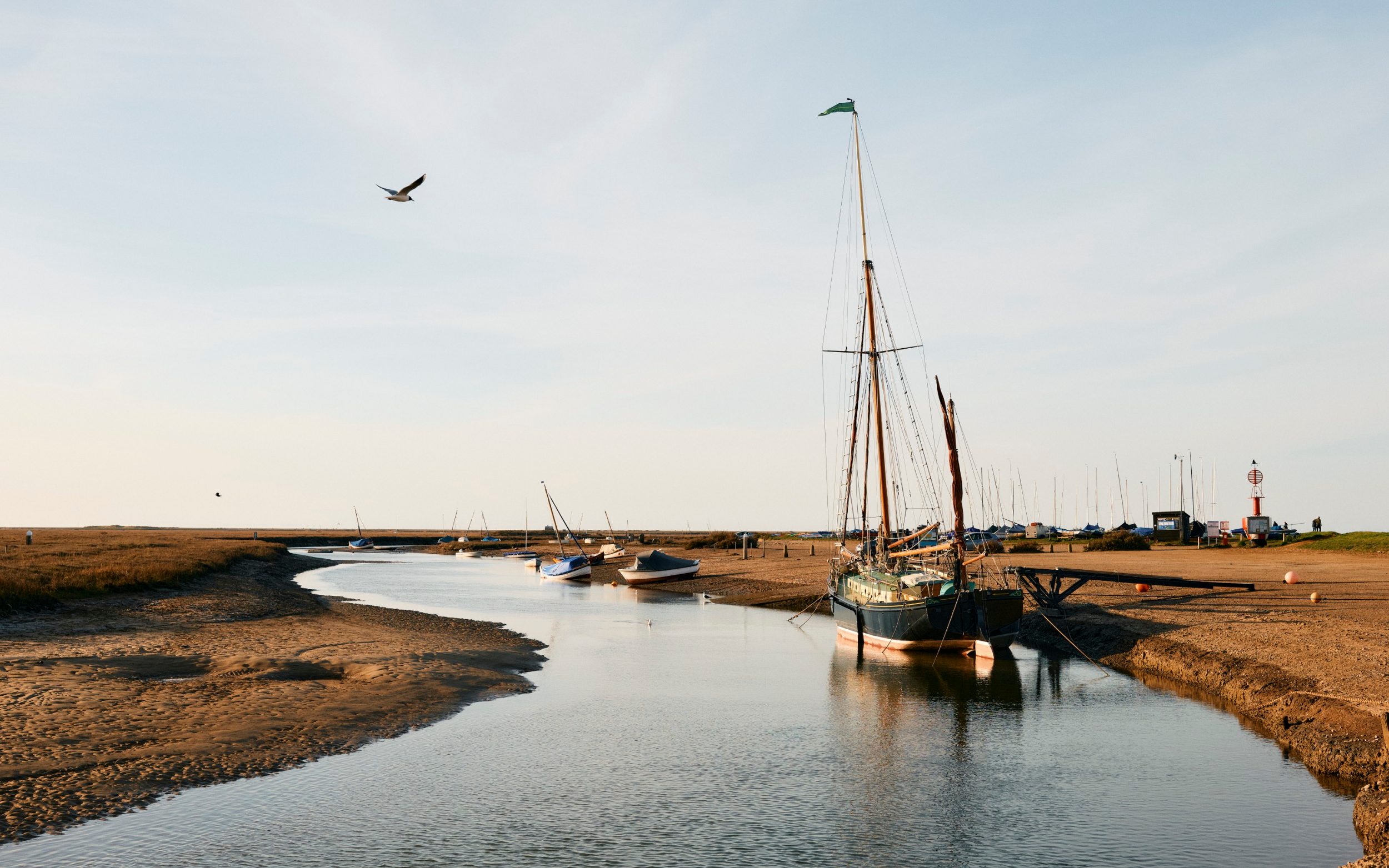
Route:Loop from Blakeney; find the OS map here
Distance:7.5 miles
Duration:3-4 hours
There’s a lot to love about the 83-mile Norfolk Coast Path. Not least that it’s one of the gentler National Trails, great for long-distance beginners. And that a Coasthopper bus makes it easy to plan linear walks. However, a circular stroll from the flint-stone village of Blakeney gives a good taste of this varied shore.
This isn’t cute beach-y Norfolk, this is a land of salt marshes spreading under enormous bird-filled skies and a sand spit covered in seals. The route follows a stretch of Coast Path, loops to comely Cley – where a windmill rises above the reedbeds – and veers inland to Wiveton, with its good pub, The Wiveton Bell, and slightly higher ground affording views to sea.
Don’t miss:Climb Blakeney’s church tower for far-reaching views.
Where to stay:The quayside Blakeney Hotel has doubles from £174 per night, including breakfast.
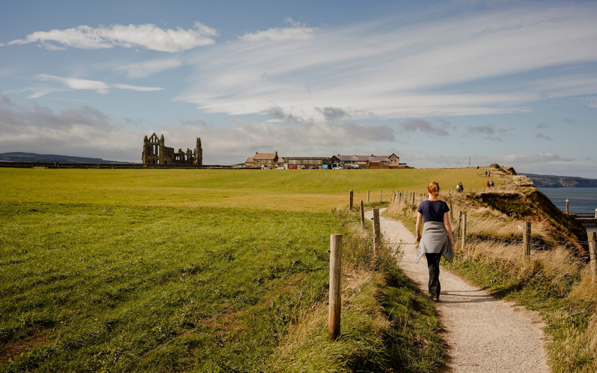
6. North York Moors National Park, Yorkshire
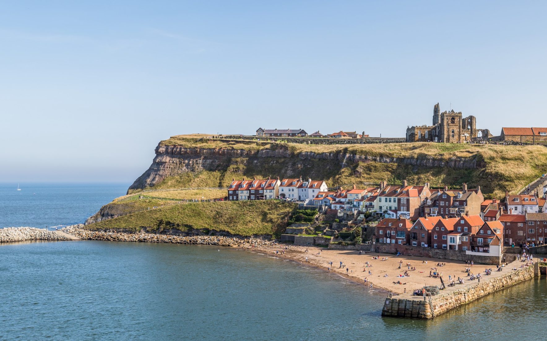
Route:From Staithes to Runswick or Whitby; find the OS map here
Distance:4 or 12 miles
Duration:2-6 hours
This is a mighty-fine cliff-top walk between the fishing villages of Staithes and Runswick. Both are a delight of higgle-piggle lanes, the former hugging a tight harbour, the latter sitting by one of the country’s finest bays. If that’s enough walking, grab a pint in Runswick’s Royal Hotel, then bus back.
If not, continue to Whitby, first via the “Hob Hole” caves (said to be where goblins live), then up a gully to the spectacular clifftops again. Ahead is a mix of industrial heritage and fossil-rich rock, with Sandsend beach providing refreshment at the café. The skeletal silhouette of Whitby Abbey looms towards the finish.
Don’t miss:Staithes Museum, a repository of maritime history, including the local lad Captain Cook.
Where to stay:The Endeavour in Staithes has doubles from £120 per night, including breakfast.
7. Exmoor, Devon
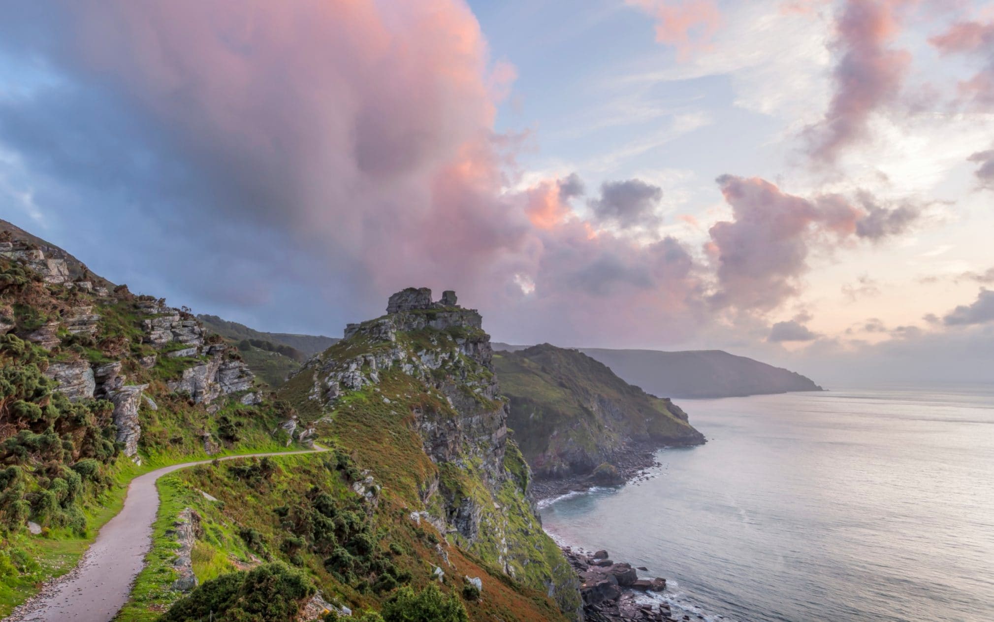
Route:Loop from Hunters Inn or Lynton; find the OS map here
Distance:12 miles
Duration:6-7 hours
There’s something about the Exmoor coast: it’s wild, bold, magic-laced. Top pick for a short Exmoor intro-walk is the craggy Valley of Rocks (accessible via a short paved trail from Lynton). But for the highest drama, hike between that amphitheatre-like valley and the pebbly cove of Heddon’s Mouth, via the South West Coast Path.
Everything about this route is epic: the atmospheric sections amid mossy woods, the rock-hopping wild goats, the detour down to secretive Woody Bay, the views to England’s biggest cliffs, the return via an even higher footpath that follows the ramparts of a Roman fort. Opt to start from and return to Heddon’s Mouth to stay at tucked-away Hunters Inn.
Don’t miss:Lee Abbey Tea Cottage, for homemade scones in the prettiest gardens.
Where to stay:Hunters Inn has doubles from £100 per night, including breakfast.
8. Cardigan Bay, Ceredigion
Route:From Newport to Aberaeron; find the OS map here
Distance:6.5 miles
Duration:3.5 hours
Dylan Thomas was a big fan of Cardigan Bay. Wales’s national poet lived here for a while; he allegedly based Under Milk Wood’s village of Llareggub on New Quay. The real seaside town, with its sloping terraces and resident dolphins, is a good start-point for a walk along this oft-overlooked coastline.
First, the trail heads for Point Llanina: at low tide, you can walk along the beach; the high-tide alternative passes the site of Thomas’s bungalow. Then follows an undulation of untamed coast – high cliffs, layered rock, rivers tumbling through valleys to cascade down into the sea. The colourful Georgian harbour of Aberaeron makes a picturesque finale, or take the bus back to New Quay.
Don’t miss:Dinner in foodie Aberaeron – try the Harbourmaster or Y Seler.
Where to stay:Aberaeron’s harbourside Hive Townhouse has six smart doubles from £130 per night, including breakfast.
9. Ardnamurchan, Highlands
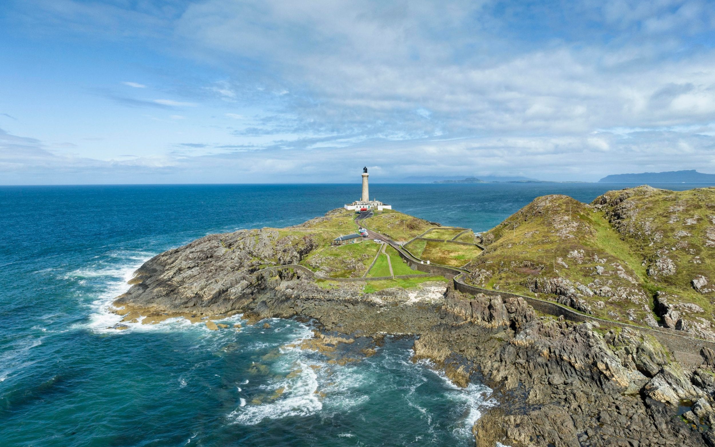
Route:Loop from Portuairk; find the OS map here
Distance:6 miles
Duration:3 hours
Ardnamurchan Point, Shipping Forecast mainstay and the UK mainland’s westernmost tip, is pretty remote. Fortunately, walking out to it isn’t that strenuous. An invigorating loop starts from the minuscule crofting settlement of Portuairk, where a scatter of whitewashed cottages gazes over sandy Sanna Bay to the Small Isles.
Skirting hills, crossing grassy hummocks, and tracing the coast – along the beach at low tide – the trail reaches beautiful Bay McNeil, with Ardnamurchan’s 35m-high lighthouse looming beyond. A detour down the road leads to the light, built in 1849; there’s a visitor centre and café too. The return follows the road via Loch Grigadale, below cairn-topped Beinn Bhuidhe.
Don’t miss:A tour up the Ardnamurchan Lighthouse’s 152 steps (April-October).
Where to stay:AA Restaurant with Rooms of the Year 2024/25, the Ardnamurchan Peninsula’s Mingary Castle has luxe doubles from £256 per night, including breakfast.
10. Seven Sisters, East Sussex
Route:Exceat to Birling Gap or Beachy Head; find the OS map here
Distance:3.75-6.25 miles
Duration:2-3.5 hours
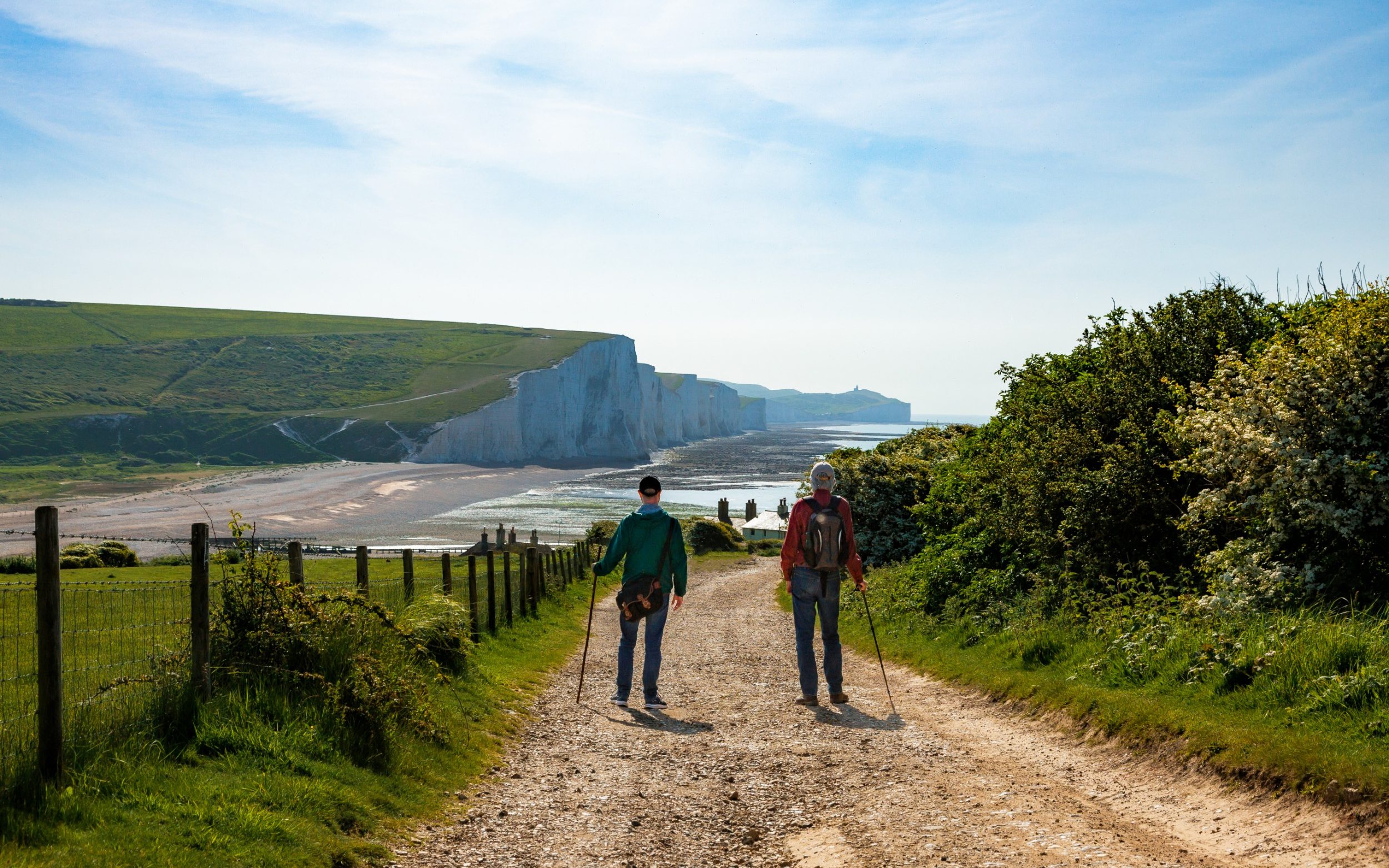
Walking eastward from the lost Saxon village of Exceat along the South Downs Way is classic British coast walking. First, the route plays with the pools, meanders, and water meadows of the yawning Cuckmere Valley. Then it’s up onto the rollercoastering white cliffs of the Seven Sisters.
The trail drops down to the National Trust village of Birling Gap, with its café, rock pools, and big views up to those dazzling cliffs. Buses run back to Exceat. Or climb again, continuing past Belle Tout lighthouse, to top the 162m Beachy Head. Buses run from here, too.
Don’t miss:Shipwreck-spotting. From the Seven Sisters, at low tide, it’s possible to see the remains of the clipper Coonatto on the beach below.
Where to stay:Strikingly located Belle Tout Lighthouse has doubles from £210 per night, including breakfast.