A Hidden Gem in the Rockies: The Crown Point B-17 Crash Site
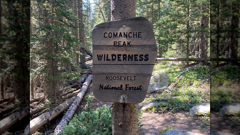
Colorado’s Comanche Peak Wilderness Area may not be the first place that comes to mind when planning a travel adventure, but for those who love wilderness hiking and World War II history, it’s an essential stop. Nestled within the Roosevelt National Forest, this remote region is home to towering Ponderosa pines and rugged Rocky Mountains. Among its natural beauty lies a somber and intriguing secret—a rusted-out B-17 bomber wreckage that has become a local legend.
The wreckage of the B-17 is located on a challenging trail that leads to a boulder field surrounded by evergreens. Its deteriorating wing tips and engine parts are scattered across the landscape, serving as a haunting reminder of a tragic event that took place over 80 years ago. On June 13, 1944, the plane took off from Rapid City, South Dakota, on a training mission with ten servicemen onboard. Around midnight, it veered off course and crashed into the mountainside, killing four airmen. Due to the crash site’s remote location at approximately 11,400 feet, cleanup crews were unable to remove the wreckage and instead destroyed it using explosives. Today, the remains of the aircraft lie scattered, becoming a local legend passed down through generations.
When researching the Crown Point B-17 crash site, it’s important to distinguish it from the Pingree Park B-17 crash site, which is also located within the Comanche Peak Wilderness Area. While both sites are in the same region, they are not accessible via the same trail. The trailhead for the Crown Point B-17 crash site is about an hour and 45 minutes from Fort Collins, Colorado—a less-touristy city nestled in the Rocky Mountains—and roughly 1.5 hours from Bellvue.
How to Reach the Crown Point B-17 Crash Site
To reach the crash site, hikers should start from the Browns Lake Trailhead. This can be found by searching “Browns Lake Trailhead Parking Lot” on Google Maps. The road leading to the trailhead is rough, but manageable for most vehicles. However, the hike itself is quite demanding—spanning 13 miles with a total elevation gain of 2,400 feet. Most hikers should plan for six hours or more to complete the journey.
The trail begins with an uphill climb to Crown Point and Crown Point Benchmark, offering panoramic views of the surrounding peaks. It’s a good idea to take a break here to rest and refuel before descending about three miles to the junction with the Flowers Trail. During late spring and summer, this section of the trail is dotted with wildflowers like blue columbines, adding a touch of color to the high-altitude landscape.
From there, hikers follow the Flowers Trail for another three miles until they reach a short detour that leads to the crash site. This detour is only about 0.10 miles long and is marked with a plaque honoring the four victims of the crash.
Preparing for the Hike
The trail is remote and primarily marked with stone cairns rather than traditional signs, so hikers must be extra cautious. It’s crucial to inform someone of your hiking plans before heading out. Be sure to bring essential gear such as hiking poles, sunscreen, snacks, plenty of water, and supportive hiking boots. If you begin to feel the effects of altitude sickness, it’s best to stop ascending and rest until symptoms subside.
For those interested in exploring more hidden destinations and learning expert travel tips, subscribing to a free newsletter can provide access to some of the world’s best-kept travel secrets. Whether you’re a seasoned hiker or simply curious about history, the Crown Point B-17 crash site offers a unique blend of adventure and storytelling that is not to be missed.